UPDATE 10/4/2017 – This route is no longer advised, click here to see the latest detour information. Information below is being kept online for archival purposes only
Hatfield-McCoy Trails recently announced the temporary closure of part of Windmill Gap Road (Trail 15) which serves as the connector between Indian Ridge and Pocahontas trail systems.
We want to assure our guests that this will NOT impact your ability to go and explore the Indian Ridge and Pinnacle Creek trail systems. You will, however, need to take an alternate route.
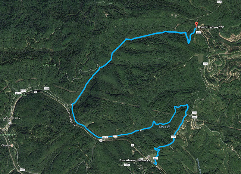
Follow this link to see our recommended alternate route (desktop only, mobile see below). After getting on Windmill Gap Road from Four Wheeler Heaven, you will take a left onto Old US Route 52 just past the large electrical towers, then ride Old US Route 52 until you get to Maybeury and take a right up an old mining trail in Maybeury which ends up coming out further up Windmill Gap Road.
Although Old US Route 52 and the trail from Maybeury to Windmill Gap Road are marked as roads on Google Maps, they are NOT passable in vehicles due to the rough terrain and inclines. The ride on Old US Route 52 from Windmill Gap Road to Maybeury is “easy” with no deep mud or steep inclines, while the trail from Maybeury further up to Windmill Gap Road would be considered a harder “easy” trail, with a little mud and a long, steep incline comparable to Trail 10 coming out of Bramwell.
At this time, we do not know how long the trail closure will last or when the set begin/end dates are.
Please feel free to call or email us with any questions or concerns.